

Conveying a Vision
by Bobby Gaddis
In the development process for large tracts of land one of the hardest things for people is to see the vision.
See the vision of a connected development
See the vision of new amenities, both structural and natural, available to them
See the vision of transformation that could happen
See the vision of excitement
Throughout much of the past and continuing on today, conveying this vision to others has been done in a similar fashion with the use of rendered site plans. These illustrations will always have a place in the development process and will continue to be an important asset to any developer. Sometimes though, the rendered site plan alone doesn’t provide the infectious excitement to others that the developer has for the project.
Recently we had the opportunity to work on a large tract concept in Burleson, Texas for a developer headed to ICSC this week. RA Development LTD, the developer, wanted to be able to present this property in a way that provided a clear vision of what the site could become. So as would be expected for this type of conceptual planning, our talented planning department took the initial ideas from the client and came up with a rendered site plan.
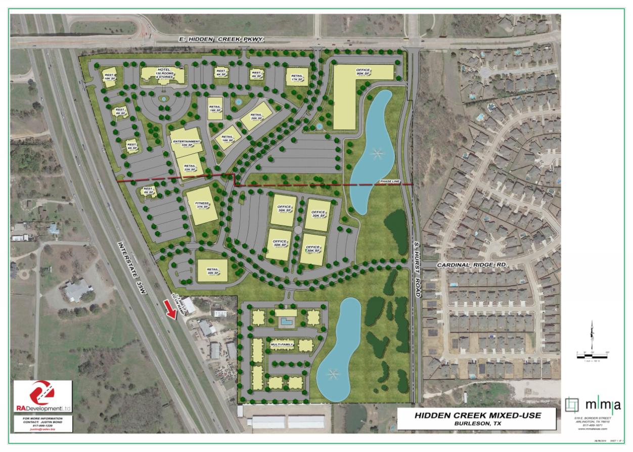
Rendered Site Plan
This is a great start, but at mma we have a refined set of tools and technical knowledge to take this site plan to the next level.

Infraworks Models
Images like this are what will start to bring in that excitement for a project and before I lose you with an “I bet that took a lot of time”, you will be surprised at the amount of effort that is put into making a model like this. Before we dive into this model with more images/video, there are a few tools that mma uses to make things like this possible that you should know about.
The first thing to know is that this is an actual grading concept created by an engineer (me in this case). If you look closely at the video later below, you will see that there are curbs and walls graded in which usually are ignored in other models you might have seen like this. To be able to provide this level of detail and also verify that the concept will work from a grading standpoint, we use a tool called Siteops. Siteops is a grading optimization software that allows the engineer to input grading constraints such as builds, parking areas, islands, ponds, etc. and the software will provide a grading plan and feedback of whether your plan is achievable. From that feedback, the engineer can then begin to add in retaining walls, adjust slope constraints, or adjust the site to produce a feasible overall grading plan that can later be taken into detailed design confidently. This iterative process by the engineer is very quick and provides enough detail for the overall elevation change throughout the site to be shown in the model.
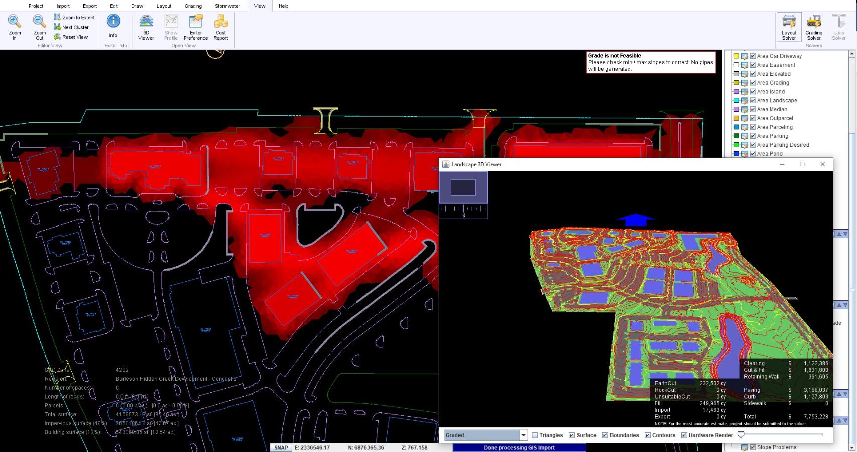
Siteops
The next significant tool mma utilizes for the actual model creation is Infraworks. This is a tool that allows us to quickly aggregate several different data sources into one completed model. A few of the different data sources we use in large models like this are lidar data for the site and surrounding topography, any onsite topography that has been completed, the proposed surface we get from Siteops, the linework from the concept plan CAD to create the different material areas and buildings, and finally points from the CAD file that represent locations of people, trees, and cars.
The great thing about Infraworks is that changes can quickly be updated in the model from the CAD work that was changed. It’s so quick to put these models together, in fact, our engineers usually create one at some point during every project, with less detail, to verify grading and utilities look correct even if the client never ends up seeing any images/videos from the model.
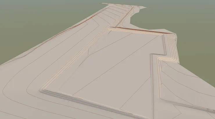
Basic infraworks model with no hatching
At mma we train all of our staff to use tools like this and collaborate across departments to provide our clients with deliverables and insight that wouldn’t be expected from planners or engineers on their own.
Take a look at the final video of the development we put together below.
Couple fun facts about this model. There are:
- 2100 cars in the parking lots and drive aisles
- 325 people around the site
- 350 individual trees not counting the forested areas
- a 30’ tall person that can be seen at 1:27 on the left side of the screen across the street from the building (oops)
We hope that you will give us a call on your next project and let us help take your vision to the next level.